RTK Rover Systems
Field-ready GNSS receivers for precise positioning in professional environments.
Norvex RTK GNSS systems deliver high-precision real-time positioning using reference stations, rover receivers, and correction data links for professional and industrial applications.
RTK, or Real-Time Kinematic, is a high-precision GNSS positioning method that improves accuracy from meter-level to centimeter-level by using real-time correction data. Unlike standard GNSS positioning, RTK compares satellite observations from a fixed reference station and a moving rover receiver to reduce errors caused by atmospheric effects, satellite orbit uncertainty, and receiver clock bias.
RTK GNSS is widely used when accurate and repeatable positioning is required, including land surveying, construction layout, machine guidance, precision agriculture, and autonomous navigation.
A complete RTK system typically includes a reference station or CORS station, a rover receiver in the field, and a communication link that transfers correction data in real time. The reference station observes the same GNSS satellites as the rover and computes correction information, which is then transmitted through radio, internet, or NTRIP communication. The rover applies these corrections instantly to achieve centimeter-level accuracy.

The rover is the mobile RTK GNSS receiver used in the field. It receives satellite signals and real-time correction data to produce accurate coordinates for surveying, construction, and industrial applications.
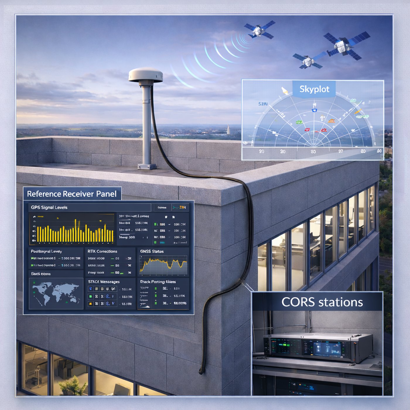
A CORS station, or Continuously Operating Reference Station, serves as the fixed reference point in RTK positioning. It continuously tracks GNSS signals and generates the correction data needed by rover receivers.
RTK correction software distributes real-time correction data from reference stations to users. In modern deployments, this is often done through NTRIP services over cellular or internet networks.
The main advantage of RTK GNSS is its ability to deliver centimeter-level positioning in real time. This makes RTK one of the most effective technologies for applications that require precise alignment, repeatability, and navigation confidence.
Control surveys, topographic mapping, cadastral work, and high-accuracy field measurement.
Machine guidance, layout, alignment control, and precision site operations.
Precision guidance for tractors, robots, drones, and autonomous mobile platforms.
Norvex provides RTK GNSS system components and integrated solutions, including rover receivers, CORS infrastructure, correction data workflows, and application-specific integration support.
Field-ready GNSS receivers for precise positioning in professional environments.
Reference station architectures for local or network-based RTK deployments.
NTRIP and communication workflows for scalable, real-time positioning services.
Contact Norvex to discuss RTK GNSS configurations tailored to your accuracy, coverage, and integration requirements.
Request Information